May 24, 2022 – Riga, Latvia –
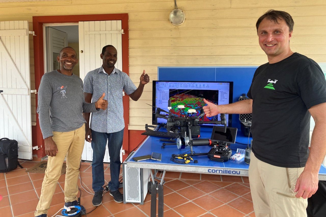
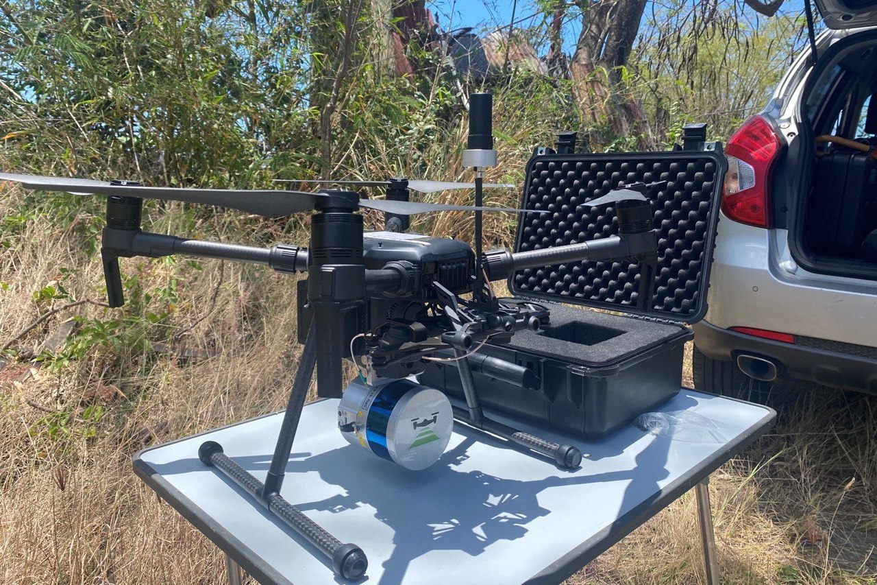
TOPODRONE, the partner of SPH Engineering, supports a client from MaTopo company, Martinique, to perform a drone-based survey project of power lines. The company has provided an advanced training workshop which included the whole workflow of UAV-based LiDAR surveying. Flight missions were planned in UgCS.
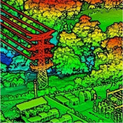
Located in the Caribbean Sea, the Martinique island has a rugged mountainous terrain due to the recent volcanic activity and is overgrown with dense tropical forests. So the use of conventional survey techniques with RTK & total stations as well as drone photogrammetry are not feasible in such area. Only drone based LiDAR allows to perform mapping and to get terrain level under deep canopies in a fast way saving hours and days of manpower.
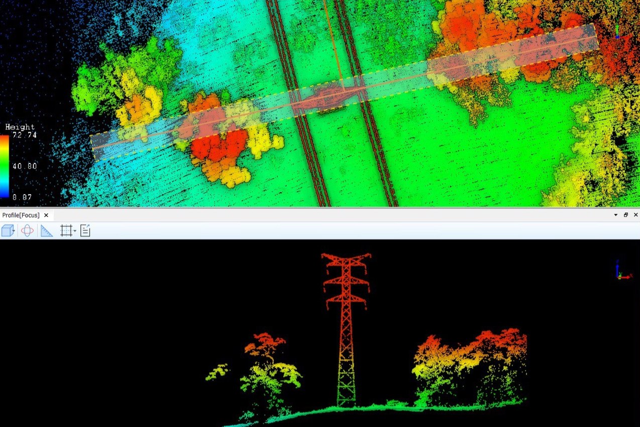
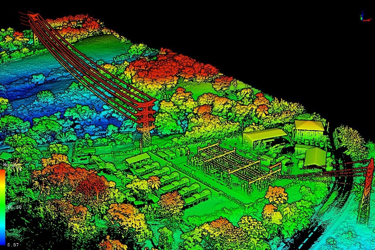
TOPODRONE offers clients innovative drone based survey grade LIDAR systems which provide high accurate, low noise, dense point cloud.
出典:
https://sph-engineering.com/news/ugcs-used-for-drone-based-lidar-survey-at-martinique
ご参考:
(株)光響が提供する製品情報:LiDAR(バックパック型・超高点群密度・ソリッドステート)
In case of addition or removal of the article, please contact us as below:
info@symphotony.com
この情報へのアクセスはメンバーに限定されています。ログインしてください。メンバー登録は下記リンクをクリックしてください。