Eagle X Makes Lidar Mapping More Accessible in Mexico, Central America, and South America
Techmake Solutions is including Velodyne lidar sensors in its Eagle X mapping and surveying system.
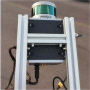
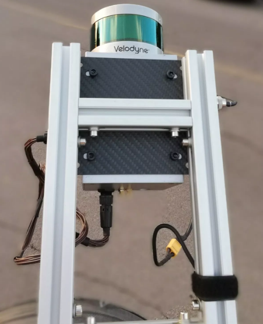
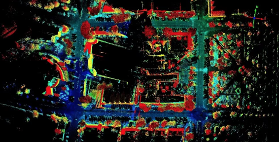
Velodyne Lidar, Inc. today announced that Techmake Solutions, S.A., an IT consulting and technology development company headquartered in Monterrey, Mexico, is including Velodyne lidar sensors in its Eagle X mapping and surveying system. Velodyne’s lightweight lidar sensor provides Eagle X unmanned aerial vehicles (UAVs) a high-resolution image that allows users to accurately measure and analyze any landscape.
“Industry leaders rely on Velodyne’s rich computer perception data to provide high-performing mapping systems in a compact solution”
Velodyne sensors provide Techmake Solutions’ Eagle X UAVs with a high-resolution image to accurately measure and analyze any landscape. (Photo: Business Wire)
The Eagle X system will be introduced in 2019 to address aerial-mapping system needs within the fields of geography, surveying, topography, and natural resource management in Mexico, Central America, and South America.
この情報へのアクセスはメンバーに限定されています。ログインしてください。メンバー登録は下記リンクをクリックしてください。