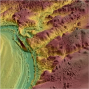
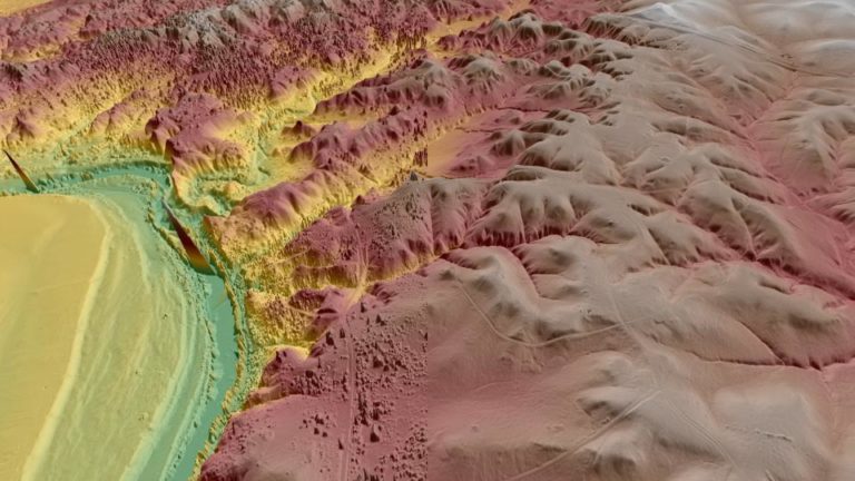
 Converted point cloud with (left) and without vegetation points (right) displayed with the Hill Shade and Elevation lenses.
Virtual Surveyor has enhanced the LiDAR elevation data handling capabilities in Version 6.4 of its drone surveying and mapping software. A new function enables Virtual Surveyor users to select specific feature classes from classified LiDAR point clouds before converting the point cloud to a surface terrain.
この情報へのアクセスはメンバーに限定されています。ログインしてください。メンバー登録は下記リンクをクリックしてください。