日本語で読みたい方は、
google chromeで開いて、
画面上で右クリックをして
「日本語に翻訳」をクリックしてください
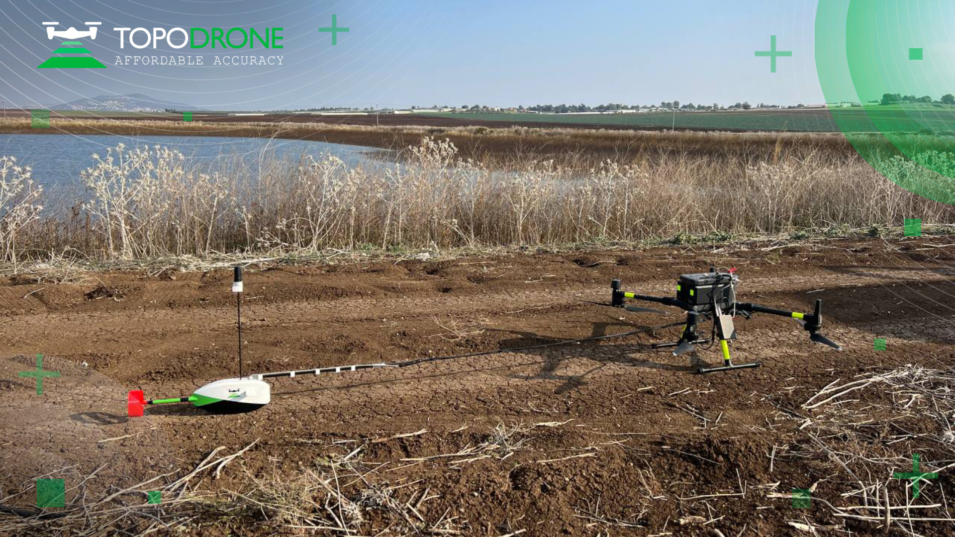
We would like to share the results of the comprehensive water reservoir survey in the northern part of Israel using TOPODRONE LIDAR HI-RES and AQUAMAPPER equipment performed by ERELIS Group. Please note that the water surface was occupied by solar panels, which made it difficult to perform survey using standard hydrographic methods with boats.
At the first step drone LiDAR survey and aerial photography were performed to identify the location of solar panels and cables in the pond, and then bathymetric survey was carried out avoiding obstacles in the water in automatic mode. UGCS software with True Terrain Following option was used together with an altimeter installed on the DJI M300 drone to keep the drone flight altitude at a required level. The bathymetric survey results are perfectly matched and integrated with laser scanning materials and the carrier for the equipment is a single UAV platform (in this case – it is DJI M300).
The set of LIDAR & Bathymetry data covers all of the customer’s needs in monitoring of water reservoirs and their surroundings. The customer received 3D model based on the results of laser scanning, georeferenced orthophoto, 3D model of the bottom of the reservoir, contour lines and isobaths. Please note that LIDAR and bathymetric survey can be performed without being close to the reservoir and at any time of the day, even in bad weather. A highly accurate three-dimensional model of the reservoir bottom can be used by the customer for high-precision assessment of sediment volumes, general monitoring of reservoir banks, and visual analysis.
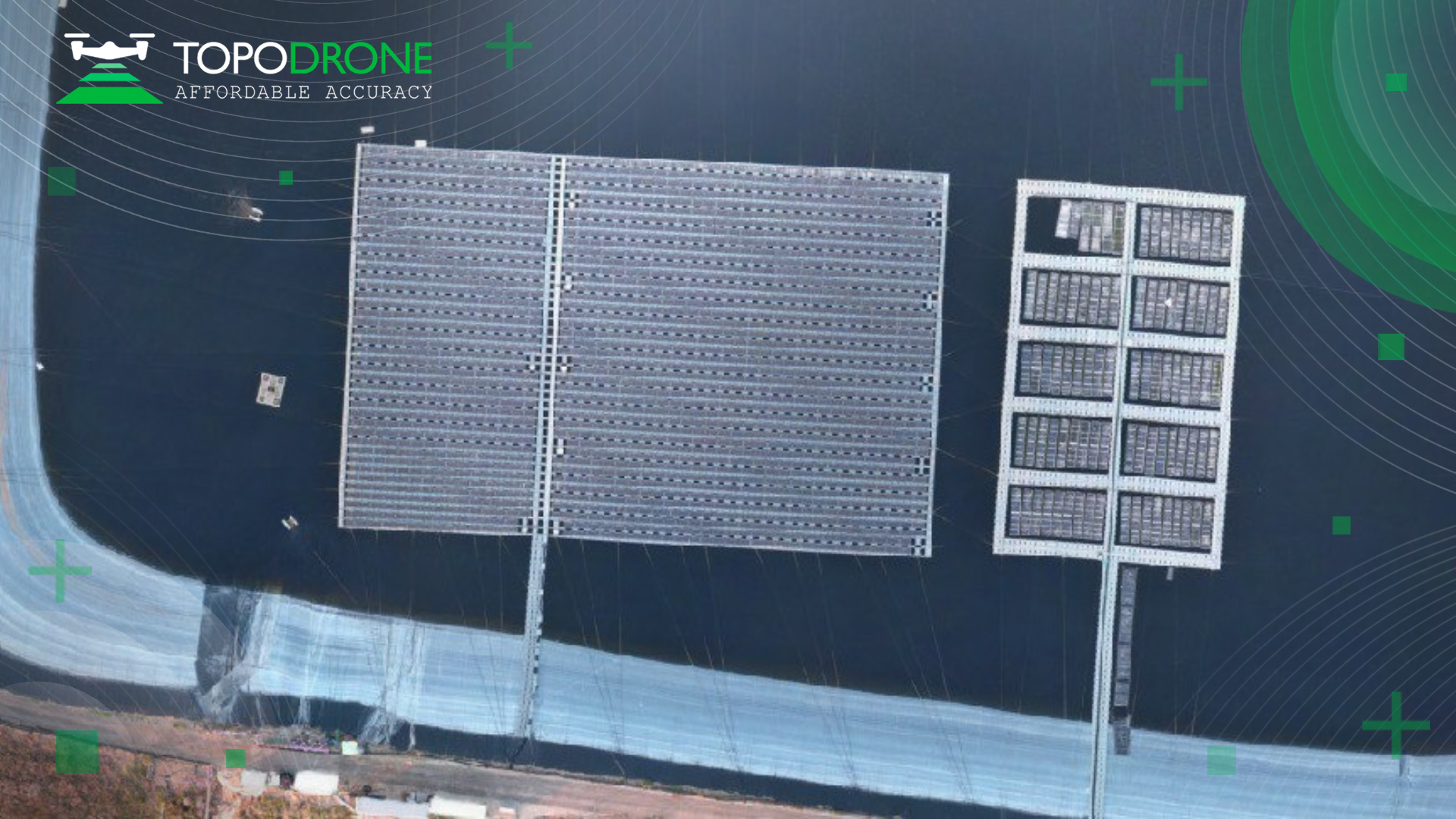
Fig. 1. Floating solar farm.
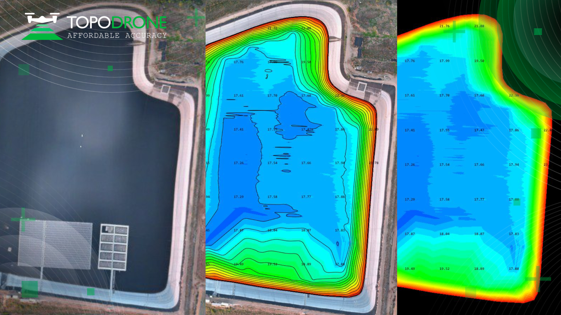
Fig. 2. Floating solar farm, orthophoto and bathymetry data of the reservoir bed.
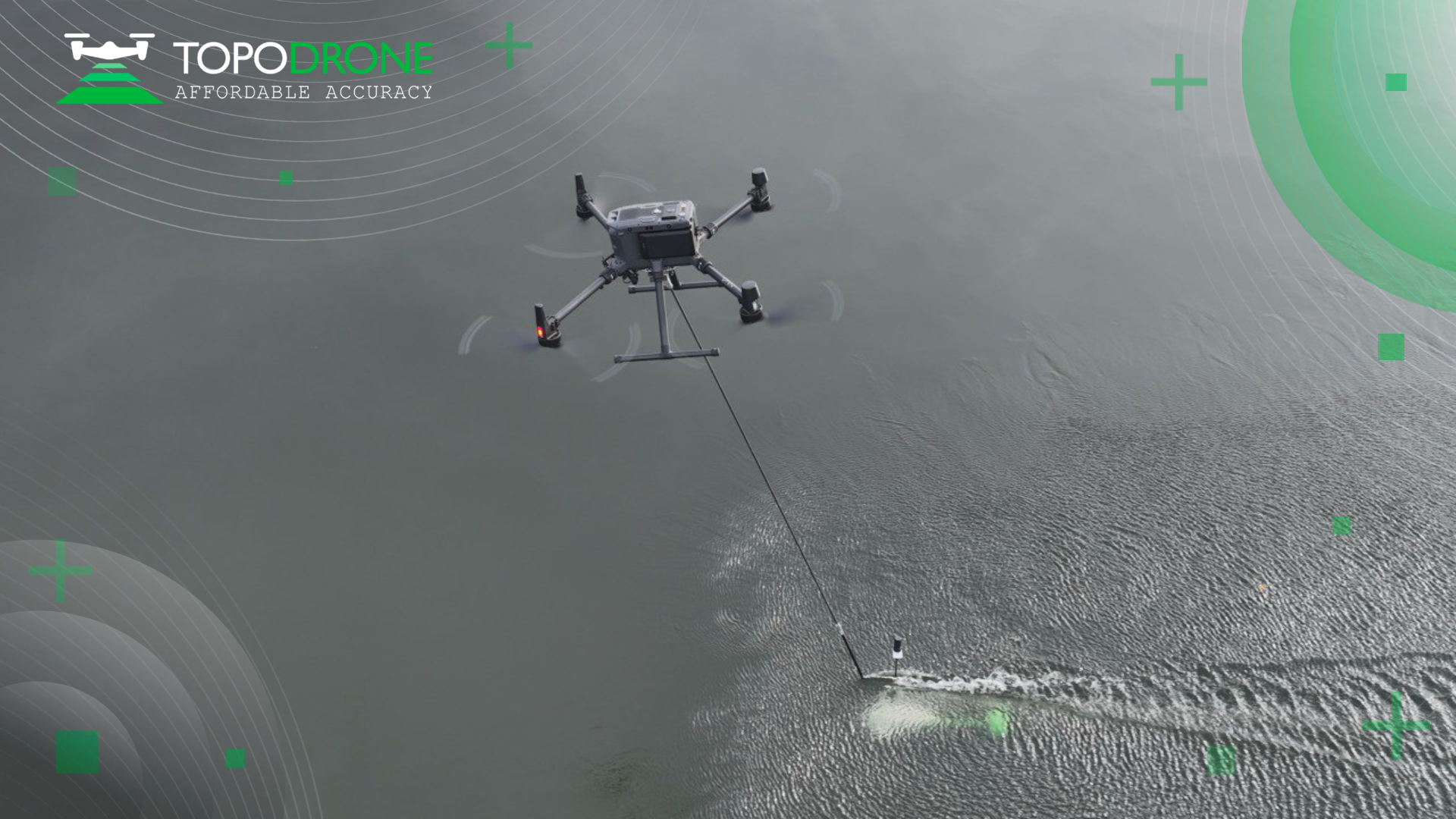
Fig. 3. AQUAMAPPER at work.
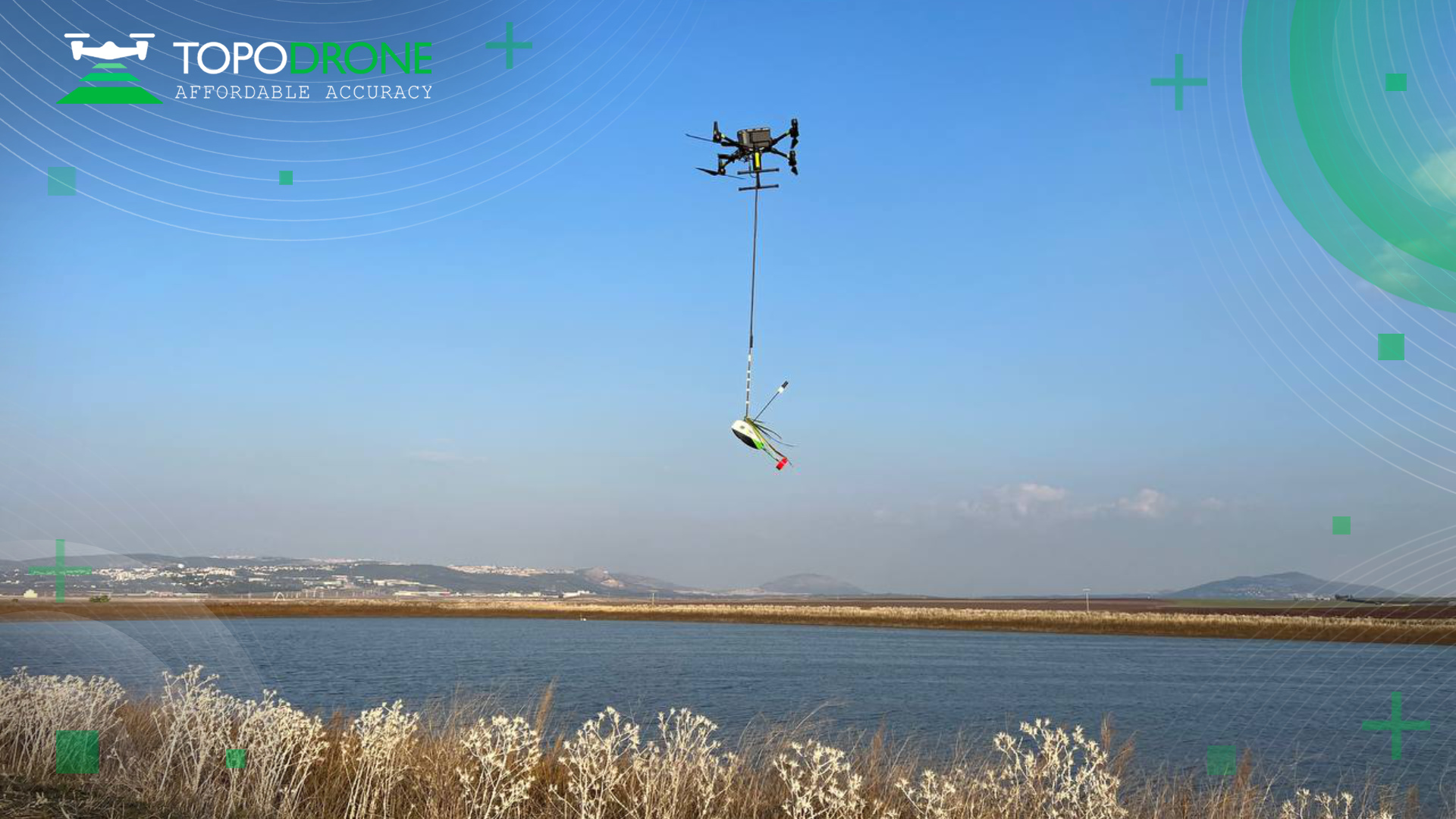
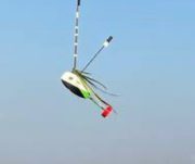
Fig. 4. Cool AQUAMAPPER haircut.
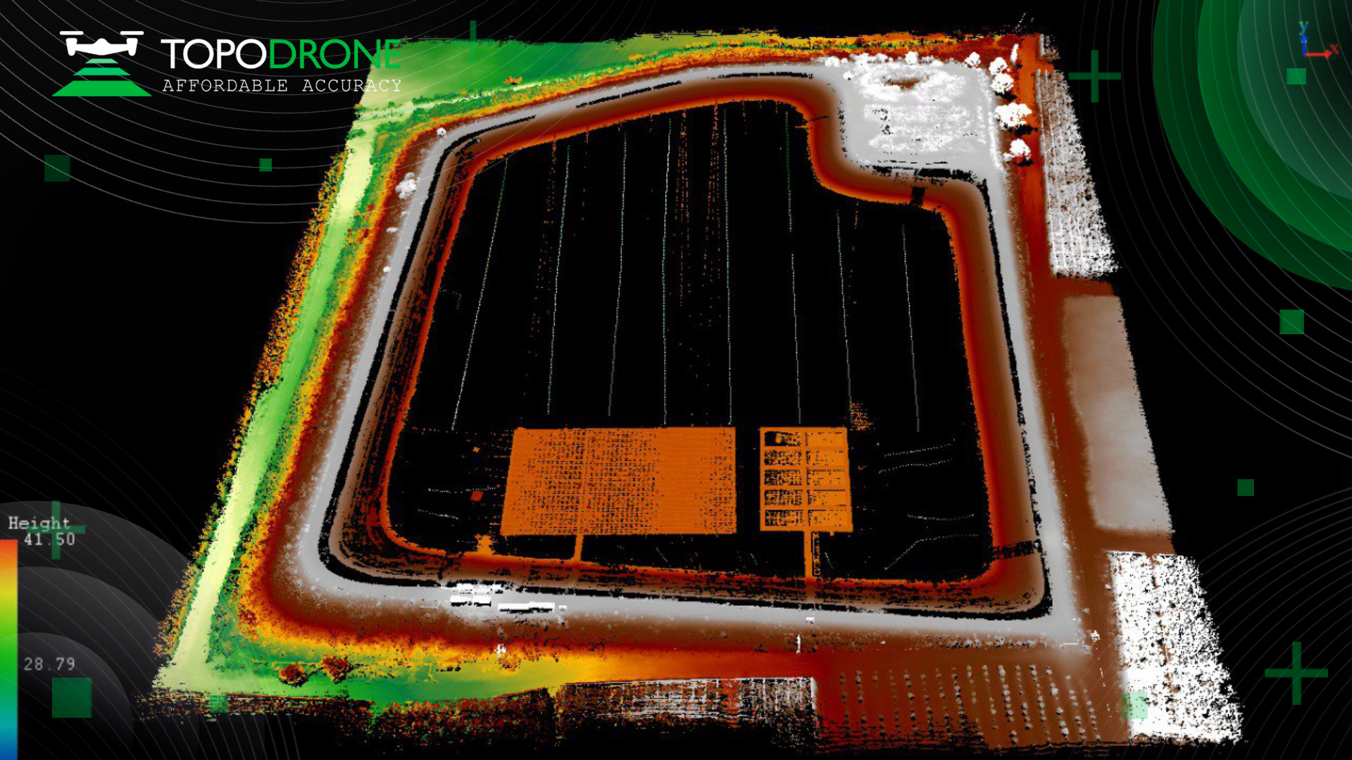
Fig. 5. LiDAR point cloud with cables and other obstacles in the water.
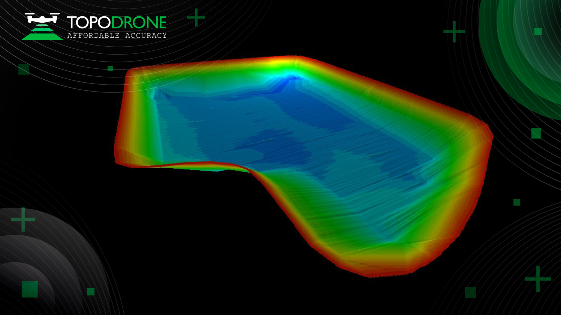
Fig. 6. 3D model of the reservoir.
出典:
https://topodrone.com/company/news/1372/
ご参考:
(株)光響が提供する製品情報:LiDAR(バックパック型・超高点群密度・ソリッドステート)
In case of addition or removal of the article, please contact us as below:
info@symphotony.com
この情報へのアクセスはメンバーに限定されています。ログインしてください。メンバー登録は下記リンクをクリックしてください。