#LiDAR
日本語で読みたい方は、 google chromeで開き、
画面上で右クリックをして、「日本語に翻訳」をクリックしてください
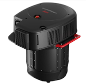
The new solution from Leica Geosystems increases hydrographic survey performance by 250% for shallow to deep waters and provides a flexible data capture solution for multiple applications
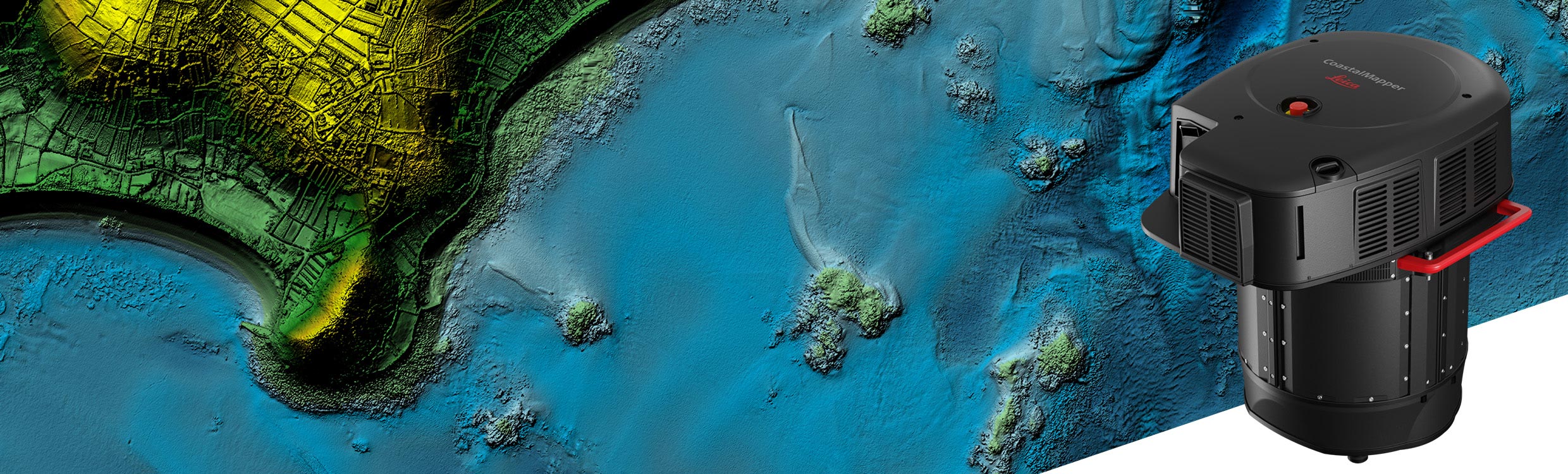
Leica Geosystems, part of Hexagon, today announced the launch of the Leica CoastalMapper. Thanks to a wider field of view and the ability to be flown at higher altitudes, the new airborne bathymetric LiDAR solution increases survey efficiency of coastlines and rivers by 250% compared to previous sensor generations.
The CoastalMapper brings a new generation of airborne hydrographic
mapping solutions to the industry and offers unmatched performance
across a wide variety of mapping applications, from infrastructure
resilience to river flood monitoring and environmental investigations in
shallow and deep waters.
“We aim to empower our community with tools that meet current needs,
anticipate future challenges and push the boundaries of bathymetric
mapping,” says Anders Ekelund, Vice President of Airborne Bathymetric
LiDAR at Leica Geosystems. “We’re beyond pleased to offer our customers
this radically enhanced system for more detailed and efficient surveys.
Powering easier yet more comprehensive data analysis and supporting a
broad range of bathymetric applications, the CoastalMapper opens mapping
possibilities that were hard to achieve before.”
Redefining bathymetric efficiency
The CoastMapper combines a new high-performance bathymetric LiDAR
module with a Leica TerrainMapper-3 topographic LiDAR and imaging sensor
into a compact and lightweight sensor head. The system captures up to
one million data points per second with the bathymetric channel and up
to two million points per second with the topographic channel, while
providing imagery at a 5-centimetre ground sampling distance (GSD) at
common flying heights.
Simultaneous collection of bathymetric and topographic LiDAR as well
as imaging enables broad data capture in a single flight, which
significantly reduces the survey time, operational costs and
environmental impact of each mission. Uniquely, the system can be
mounted to a helicopter, enabling surveying in complex environments,
such as rivers with steep mountainous terrain.
Maximum productivity for flexible applications
The CoastalMapper fully integrates with Leica Geosystems’ established
and trusted airborne mapping workflows, minimising training time and
simplifying operations for existing customers. Thanks to cluster
processing capability, users can efficiently analyse large data sets,
reducing the time from data collection to deliverable, such as
classified point clouds, digital terrain and surface models and imaging
products.
Read here for more information about the Leica CoastalMapper.
Contact:
Leica Geosystems AG, part of Hexagon
Hanna Hellstroem
E-Mail: hanna.hellstroem@hexagon.com
leica-geosystems.com
Leica Geosystems – when it has to be right
200年以上の歴史を持つHexagonのグループカンパニーであるライカジオシステムズは、世界中の測量、建設、インフラ、鉱業、マッピング、その他の地理空間コンテンツにかかわる産業のプロフェッショナルに向けて高品質のセンサー、ソフトウェア、サービスを提供しています。多岐にわたる業界のプロフェッショナルから信頼を得ているライカジオシステムズは、自律的な未来を実現するための革新的なソリューションで業界をリードしています。
Hexagonはセンサー、ソフトウェア、自律型ソリューションの世界的リーダーです。産業、製造、インフラ、安全、モビリティの各アプリケーションで効率性、生産性、品質を高めるためにデータを活用しています。
当社の技術は、接続性と自律性が進む都市と生産のエコシステムを形成し、拡張可能で持続可能な未来を確実なものにしています。
Hexagon(ナスダック・ストックホルム: HEXA B)は、50カ国で約24,500人の従業員を擁し、総売上高は約5.4億ユーロ(5.5億米ドル)です。詳細については hexagon.comをご覧いただくか、Twitterで @HexagonABをフォローください。
出典:
https://leica-geosystems.com/ja-jp/about-us/news-room/news-overview/2025/02/new-leica-coastalmapper-lidar-sensor
ご参考:
(株)光響が提供する製品・サービス情報:
・LiDAR(バックパック型・超高点群密度・ソリッドステート)
・ドローン球体ガード/イワサキドローン
In case of addition or removal of the article, please contact us as below:
info@symphotony.com
記事の追加及び削除:
記事の追加あるいは削除を希望される場合、お手数ではございますが、
以下窓口までご連絡ください。
info@symphotony.com
この情報へのアクセスはメンバーに限定されています。ログインしてください。メンバー登録は下記リンクをクリックしてください。