日本語で読みたい方は、google chromeで開き、
画面上で右クリックをして、「日本語に翻訳」をクリックしてください
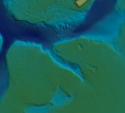
How the ambitious Florida Seafloor Mapping Initiative is setting the standard for our understanding of coastal environments
Beneath the sunlit waves of Florida lies an intricate underwater world that few have seen but many depend on. Through the Florida Seafloor Mapping Initiative, Woolpert and partners are capturing this hidden landscape in unprecedented detail. Using aircraft, ships and uncrewed vessels equipped with Lidar and sonar, they have mapped tens of thousands of square kilometres despite hurricanes and rough seas. The resulting seafloor model will enhance navigation, habitat protection and coastal resilience while deepening understanding of Florida’s marine environment.
この情報へのアクセスはメンバーに限定されています。ログインしてください。メンバー登録は下記リンクをクリックしてください。