Forest ecosystems contain more biomass than any other ecosystem. However, estimating biomass without cutting down trees is difficult. Traditional methods of estimating aboveground biomass (ABG) are based on correlations between destructive estimates of volume and diameter and/or height, which can be measured more easily in the field.
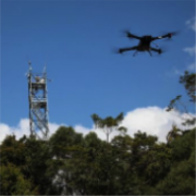
However, harvesting trees is expensive, often impractical and undesirable. 3D-FOREST, a three-year project funded by the Belgian Federal Science Policy Office led by Dr. Kim Calders and Prof. Hans Verbeeck from Ghent University, partnering with Dr. Harm Bartholomeus and Prof. Martin Herold from Wageningen University, aims at providing novel lidar in-situ 3D forest structure and biomass estimates to validate large-scale air/spaceborne biomass products. Co-incident LiDAR data from different platforms was collected to quantify aboveground biomass and forest structure in five tropical sites in Australia during a two-month fieldwork campaign in the dry season.
この情報へのアクセスはメンバーに限定されています。ログインしてください。メンバー登録は下記リンクをクリックしてください。

