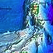
Bathymetry is the study of the underwater depth in oceans, lakes, or seas and is used to generate detailed topographical maps of bodies of water around the world. While there are several different methods of underwater mapping including sonar, in recent years LIDAR-based bathymetry techniques has become more and more popular. One of the primary advantages of LIDAR is that it can be performed by a laser mounted on aircraft or drones, enabling aerial surveillance of shallow waters and coastal regions where larger watercraft are not able to enter. Additionally, the non-contact nature of this method is ideal for use in delicate and sensitive environments, where the ecosystem can be adversely affected by submarine sonar equipment. In this blog post, we are going to discuss the basics of LIDAR-based aerial bathymetry, and briefly review the pros and cons of the technique. We will then go on to discuss the typical laser requirements for such devices focusing primarily on the laser sources used for high altitude and deep water applications.
この情報へのアクセスはメンバーに限定されています。ログインしてください。メンバー登録は下記リンクをクリックしてください。

