There are an estimated three trillion trees on the planet, and some people believe that one day we will be able to map and measure every one. Though this goal may still be far away, researchers at the University of New Hampshire have found that understanding the influence of forest structure may be the key to improving tree mapping capabilities. They are finding the trees with lidar.
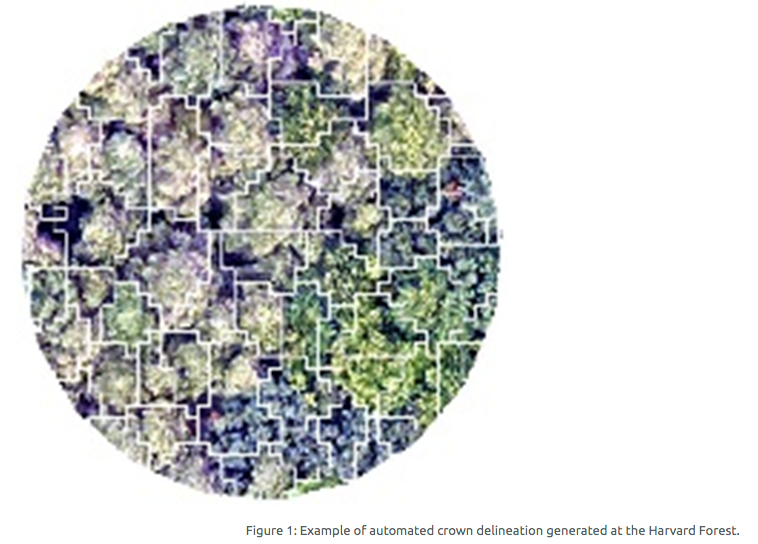
The researchers looked at the factors influencing the ability to successfully apply automated tree crown delineation methods in temperate forests. Automated crown delineation – an approach for using LiDAR to segment the forest canopy into individual trees – allows researchers to derive meaningful information, including estimates of tree size, carbon stocks, or species identity. “This information can help us manage natural resources, improve climate models, or even track biodiversity,” says Jack Hastings, a graduate student leading the project.
この情報へのアクセスはメンバーに限定されています。ログインしてください。メンバー登録は下記リンクをクリックしてください。