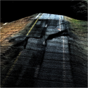
UAV LIDAR/Imagery Sensor True View 410 in Rapid Response by GeoCue President/CTO, Lewis Graham
What is GeoCue’s True View 410?
GeoCue’s UAV LIDAR/Imagery sensor, True View 410, is a 3D Imaging Sensor (3DIS) with bundled drone mapping processing software. 3DIS is a combination of both a sensor for creating a direct 3D point cloud as well as a sensor used to “colorize” the points. In the case of our UAV LIDAR/Imagery sensor, True View 410, the point cloud generator is a Quanergy M8 Ultra laser scanner and the colorization sensors are a pair of 20-megapixel (MP) photogrammetric GeoCue Mapping Cameras. The complete drone mapping software, True View Evo, needed to process the data from raw collection to analytic products (visualization, classified ground, DEM, contours and so forth) is bundled with the True View 410 system.
I am a big fan of point clouds from imagery (“photogrammetric” point clouds) as obtained from applications such as Pix4D and Metashape. We have been building support tools for these applications for years. However, (and this is the motivator for LIDAR, of course) this technique only works on non-vegetated surfaces and the data can take quite some time to process. For example, processing 1,000 images from a 20 MP camera might take up to 6 hours of compute time, even on a fairly robust computer. Processing a True View 410 flight of equivalent size (about 17 minutes of flight time) to the same point (a colorized point cloud) would take about 10 minutes. This is significant! Of course, as a bonus the colorized point cloud from the True View 410 will faithfully represent the terrain, regardless of vegetation or other ground cover.
この情報へのアクセスはメンバーに限定されています。ログインしてください。メンバー登録は下記リンクをクリックしてください。

