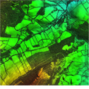
Cork, Ireland, 26 April 2018 – Detailed 3D data captured using aircraft mounted laser is helping RPS Group plan, design and engineer a major overhaul of water supply in County Wicklow, Ireland. The Bluesky LiDAR data was used to assess various route options as water supply in the region south of Dublin is rationalised. The Bluesky data was also used to enhance topographical surveys in order to understand and mitigate the risk of flooding in relation to additional water supply infrastructure.
Saeed Khan, Technical Director, RPS Europe, commented, “Bluesky use the latest aerial survey technology in order to capture LiDAR data to exactly meet the requirements of a specific project. The density and accuracy of LiDAR makes it ideal for this type of project giving unrivalled measurement of the earth’s surface and natural and man-made structures.”
この情報へのアクセスはメンバーに限定されています。ログインしてください。メンバー登録は下記リンクをクリックしてください。

