2022年09月13日 株式会社イグアス 株式会社イグアス(本社:神奈川県川崎市、代表取締役社長:矢花 達也、以下イグアス)は、2022年4月に販売代理店契約を締結したShenzhen Pudu Technology C
続きを読む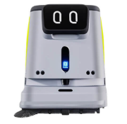
LiDAR、LiDAR技術、測域センサ、LiDAR関連
2022年09月13日 株式会社イグアス 株式会社イグアス(本社:神奈川県川崎市、代表取締役社長:矢花 達也、以下イグアス)は、2022年4月に販売代理店契約を締結したShenzhen Pudu Technology C
続きを読む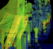
2022.08.12 TOF LiDAR is a laser emitter emits an ultra-short laser pulse, the laser is projected to the target
続きを読む
2022年9月6日 日本ペイント・インダストリアルコーティングス株式会社(本社:東京都品川区、代表取締役社長:塩谷健、以下当社)は、この度、神奈川中央交通株式会社と慶應義塾大学 SFC※研究所が共同研究・運行している自
続きを読む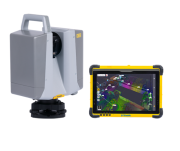
測量・建設現場での3Dスキャニングを完全自動化。既成概念を覆すワークフローで誰でも簡単・確実に、世界最高レベルの3Dスキャンが可能。 Trimble X12は、測量・建設向けに高精度・高速での3次元データが取得可能なハイ
続きを読む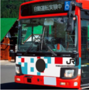
2022年9月6日 東日本旅客鉄道株式会社 JR東日本は少子化・高齢化が進むことでドライバー不足がさらに課題となるなか、持続的に公共交通を運営していくための手段として、自動運転バスの実証実験を2018年度から取り組んでき
続きを読む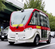
~実運行を想定した、オンデマンド運行、遠隔モニタリング、付加価値を与える車室空間の検証を実施~ WILLER株式会社(本社:大阪府大阪市、代表取締役:村瀨茂高、以下「WILLER」)、名鉄バス株式会社(本社:愛知県名古屋
続きを読む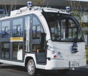
~小型自動運転EVバスで高田松原津波復興祈念公園の施設を巡回~ 令和4年8月26日 復建調査設計株式会社 アイサンテクノロジー株式会社 株式会社ティアフォー 損害保険ジャパン株式会社 KDDI株式会社 復建調査設計株式
続きを読む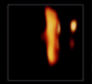
A pair of UCLA bioengineers and a former postdoctoral scholar have developed a new class of bionic 3D camera s
続きを読む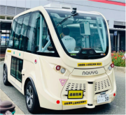
ソフトバンク株式会社の⼦会社であるBOLDLY株式会社(ボードリー、本社:東京都港区、代表取締役社⻑ 兼 CEO:佐治友基、以下「BOLDLY」)は、FUKUOKA Smart EAST推進コンソーシアム※1の協⼒の下、
続きを読む
TORONTO, O.N, Canada – August 24, 2022 – Nextech AR Solutions Corp. (“Nextech” or the “Company”) (OTCQB:
続きを読む