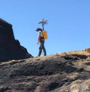
Imagine a mountaineering expedition in a wholly uncharted environment, where the hikers had the ability to generate a real-time 3D map of the terrain. NASA researchers and their industry partners have developed a remote-sensing mapping system set to aid explorers in the most isolated wilderness imaginable: the airless wastes at the South Pole of the Moon.
この情報へのアクセスはメンバーに限定されています。ログインしてください。メンバー登録は下記リンクをクリックしてください。

